| TIME | 2018-09-19 Wednesday 2200 (UTC+7) |
| LOCATION | AT SEA, 77 55,1’N / 099 54,14E |
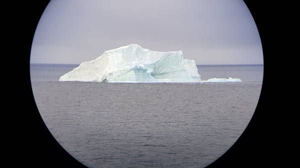
| WEATHER | Overcast, gentle breeze (NE force 3), moderate visibility, icebergs, +1 degree, 1013 mbar |
| TOTAL DISTANCE | 4648 nm |
Magnetic compass starts to have big troubles. We have about 50 degrees difference between actual heading and magnetic compass. It is due the local anomalities at the sea bed but mostly because we are now very close to magnetic North Pole. The needle of the compass is not pointing to north pole, but it tends to choose same direction with magnetic field at the place. At pole the field is pointing more and more towards earths center and vector pointing to north is diminishing. Therefore, compass have problems to settle and it can show any direction. Also, usually very reliable gyro compass has same problems as correction for latitude starts to affect quite a lot. After course change it might take a while to settle the course. Our ship is still prepared for this and on top of doubling equipment we have possibility to use DGPS and Glonass for heading, speed and position reference.
Navigation at these waters is also quite interesting. Handy nautical pilot books are in many ways not up to date to latest situation as they might refer to notes made more than hundred year ago. High latitudes also affect to bearings taken from land objects as those have some error if taken far away and charts are not so precise in that way. Mentioning charts, one has to note that, electronic charts are only covering certain areas and that have to be clearly understood while preparing route plan. Remote location makes accessing distress help challenging and crew have to prepare to survive some time on its own. That applies to communication as well. Even that ship is equipped with four different satellite communication systems only one of them is capable to have contact to satellite at their orbits. All others have satellites placed on geostationary paths which make them inaccessible from here behind the horizon.
The most fun thing still is that here you use different chart projection. On a normal Mercator projection (cylindrical equidistant) chart a straight line (rhumb line) drawn from point A to B usually can be transferred to a compass bearing (direction) which to follow to get to point B. In here while using orthographic charts that same straight line is actually a spiral curve in reality and vice versa if only one direction is used. Electronic charts simplify this matter a lot, but it must carefully monitor while performing navigation. Using Great circle navigation saves not only time but also fuel and environment.
| << OVERVIEW | NEXT ENTRY WILL BE PUBLISHED AUGUST 27 |